Report of circular walk, Par to Polkerris,
Tuesday November 25th
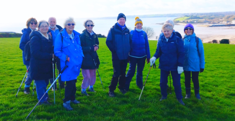

Then it was up the hill, along a short stretch of road and across the fields with panoramic views back to our cars.
A very pleasant stroll to stretch our legs on a dry November day.
Report on walk of Tuesday 28th October 2025
A 5 mile circular walk from Lerryn

Twelve members of the group met up on this sunny morning in the Lerryn Car Park for this walk which we had done about 2 years ago.
We walked past the pub, turned left at Butchers’ Cottage, walked up the road to Polperro before following the footpath sign. This took us though a wildflower meadow which is well worth coming back to through the Spring and Summer months. We stopped at various farm gates where we had excellent views of Ethy House and later we could glimpse the top of the obelisk on the Boconnoc Estate.
Having reached the settlement of Wooda Cross which offers wide views west across the Fowey Valley to the moors of St Austell – we made our way down to the historic Domesday Manor of Manely. The name means ‘on the edge of salt water’ indicating the position high above the tidal waters of the two rivers Lerryn and Fowey.
We walked down to the quay at Cliff for our coffee break – a fantastic spot with great views towards Golant to the left and towards St Winnow to the right. We also had a good view of the boathouse where a previous Prince of Wales used to entertain his mistresses.
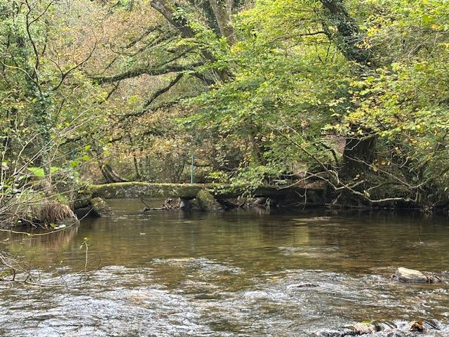
We retraced our steps and rejoined the footpath which takes you back to Lerryn through the woods. These are a pleasant mixture of oak, birch, holly, heather and bilberries with a haze of bluebells in late spring. It is said that Kenneth Grahame, whilst walking these riverside paths to Cliff, was inspired to write ‘The Wind in the Willows’
The last section of our walk back in Lerryn took us through what is known locally as Tivoli Park. Tivoli was a creation of Frank Parkyn, a successful china clay entrepreneur in Edwardian times. He lived across the River Fowey in Penquite, a handsome Georgian house set in three hundred acres and once visited by Italian nationalist, Garibaldi. In its heyday, the fountains and follies of Tivoli Park sparkled with life. Regattas, water sports and funfairs attracted crowds of people from all parts of the county. The Regatta was revived in 1953 using money left from the Coronation celebrations of Elizabeth II and the last was held in 1968. During this period the park was briefly restored to its former glory, but the undergrowth and wilderness have since taken over again.

Back in Lerryn, most people enjoyed a picnic lunch on the green in the glorious and warm sunshine. This just shows that you cannot always trust the weather forecasts!
Report on Walk of 14th October 2025
St Breward to Lank
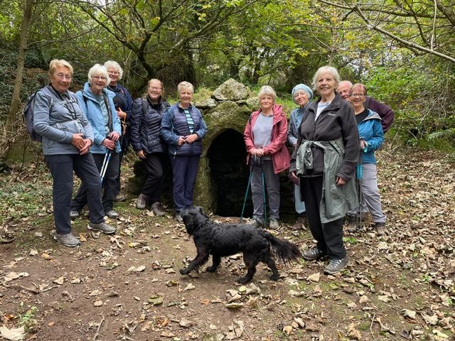
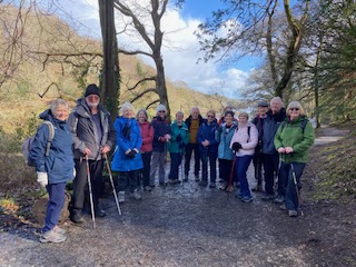
Fourteen of us gathered near St Breward Church (which claims to be the highest church in the county) to start the walk on an overcast but dry day, which was perfect for walking.
We headed across a short track of moorland, spotting one of the horses which roam free in that area, across a small field and down the fairly steep descent to the bottom of the valley, arriving close to the tiny hamlet of Tuckingmill.
From there we followed the long flat track above Lamphill Woods which was displaying the start of the beautiful Autumn colours, eventually arriving at another small hamlet, where most of us took a small diversion to visit St Breward’s Holy Well. First mentioned in 1422, it was said that the well held mystical healing powers and was able to cure “all aylements of the eyees and aforde respite from temporary blindness”!
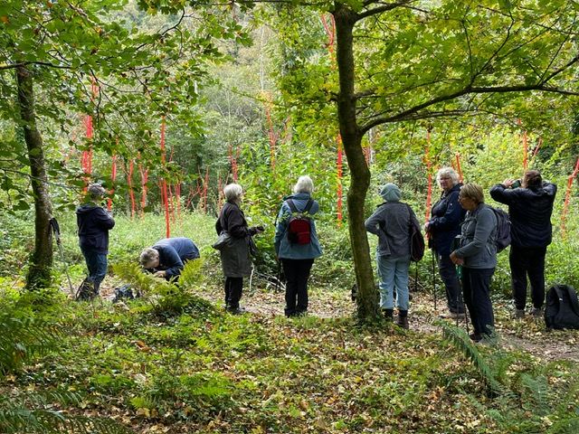
Rejoining the walk route we followed the public footpath, where we came across a collection of bare cut saplings, painted bright red and arranged amongst a section of woodland, which later research revealed to be an artistic display to commemorate all the Ash trees that died due to Ash dieback disease.
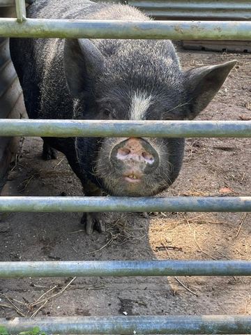
The route continued through Coombe Mill Family Holiday Farm, where we glimpsed a few of the fallow deer that live in the woods there and further on saw goats, geese, chickens, ducks and a pair of handsome pigs. Crossing a stream, we then headed a short distance uphill on the road to enter a field and descended down to the banks of the River Camel, where we stopped for lunch.
After lunch we crossed the river via the ancient clapper bridge and headed uphill, eventually emerging on the road back to St Breward.
However, the majority of us took the second optional detour and headed down Coombe Road to reach a footpath climbing up alongside a spectacular waterfall over granite boulders. This area is known as Tor Down Quarry which supplied the granite to rebuild Bodmin Jail in the 1840’s, as well supplying granite for many other famous sites, including several of the London bridges over the Thames.
We followed the walk route which took us past St Breward Primary school and along the lane which eventually comes out opposite the Old Inn in St Breward, where some of us called in for a refreshing drink before heading to our cars and the drive home.
The information on this walk on iWalk Cornwall says that it is 3 miles long – but those of us who had measured the distance found that we had in fact walked over 4 miles.
REPORT ON WALK OF 30TH SEPTEMBER 2025
SOME FRESH SEA AIR
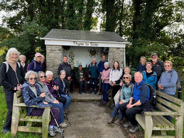
For our first walk of the new season, the early September walk had to be cancelled due to bad weather, we chose a short simple walk just to break in slowly and one with those wonderful views to the sea across the hills and beyond Fowey to Polruan.
24 of us joined us for the walk and all managed to park in the busy Coombe Farm Car Park ready to start the walk at 10.20am. We then walked towards the coast and down to Readymoney Cove where we had our coffee and for some cake from the café and a pleasant view in the sunshine out to sea. We then walked up the path to Lankelly Lane and had our photos taken in the famous bus stop.
Just a short walk along the road took us back to the Car Park- a good start to our 2025 autumn/winter season.
REPORT ON WALK OF 8TH JULY 2025
A SEMI CIRCULAR WALK FOWEY TO GOLANT
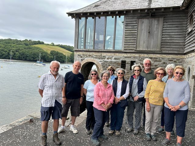
Twelve walkers met up in the Old Station Car Park in Fowey, set off for this walk on a overcast but warm morning and joined the Saint’s Way having turned right onto Penventinue Lane.
The Saint's Way, or Forth an Syns, is a long-distance footpath that cuts right across Cornwall from Padstow on the north coast to Fowey on the south. Roughly 27 miles long, the route only came to light in 1984 when local ramblers investigating public paths found a series of forgotten granite stiles. The footpath features historic remains, ancient footbridges, old tracks and fascinating churches and passes through a rich and varied landscape of valleys, woodlands, pastures, moors and ancient field systems.
You can reach Golant by walking on the upper or the lower footpath. We chose the lower path which takes you past the The Sawmills, still operating as a recording studio. Here is the information that can be found on their website: “The Sawmills was established in 1974 as one of the first residential recording facilities in the U.K. Set in its own unspoilt tidal creek on the banks of the River Fowey in Cornwall, the Sawmills boasts one of the most picturesque and atmospheric locations for a recording studio anywhere in the world. The main building is a 17th century water mill; the site has a documented history stretching back to the 11th century. Over the past 3 decades the Sawmills has evolved into a unique balance between modern technology and the outstanding natural beauty of the Cornish countryside to produce a perfect environment for creative work. Recording artists from XTC to Robert Plant, The Stone Roses to Oasis, The Verve to Supergrass and Muse, have all remarked on and benefited from the special creative atmosphere that the Sawmills provides”.
We had a late coffee break/early lunch on the quay which faces the confluence with the Trebant Water which flows through Penpol. It was quite windy there and even chilly in contrast with the hot, humid weather during the walk.
Our return journey took us on the upper path. The vegetation was very lush and when we reached the top of the ridge, we got stunning view over the River Fowey, Penpol Creek, Cliff and St Winnow Point. In the distance, we could see one of the ospreys nesting platform erected in the land owned by Haye Farm on the bank of Penpol Creek thanks to a project led by the Friends of the Fowey Estuary.
Although there are no stiles on this relatively short walk, there are not many flat sections and you are always walking up or down (4 hills). This in addition to the humidity made this last walk of the summer quite challenging.
Report on walk of 10th June 2025
Train-assisted walk Lostwithiel station to Bodmin Parkway
and then back to Lostwithiel through Respryn and Restormel
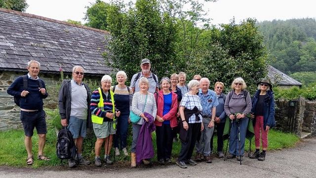
On Tuesday 10 June 2025, a group of 16 walkers met to undertake a pleasant and easy walk from Bodmin Parkway station to Lostwithiel. We caught the 10 am train from Lostwithiel station, arriving at Bodmin Parkway a few minutes later. There was some Cornish mizzle as we set off, but luckily no serious rain, and we enjoyed a scenic walk to Respryn along Station Drive. At Respryn we stopped for a coffee break at The Brew Box. We then crossed over a stone medieval bridge and entered Respryn woods, walking alongside the river for the most part, and enjoying the lovely green mixed woodland and the birdsong. Leaving the woods we walked on footpaths through two fields, to reach Restormel Road. By then the weather had cheered up and become quite warm. This scenic little road is very quiet, and you catch glimpses of Restormel Castle on a hilltop along the way, as well as having lovely views of hillsides, woodland and the river. There was a little more traffic as we neared the end of our walk, and when we reached the end of Restormel Road, having enjoyed a walk of approximately 4 miles, walkers went off to find lunch in the various cafes in Lostwithiel.
Thank you Lindsay for leading this very pleasant local walk.
Report of walk on 13th May 2025 Plymouth
Everything but an aeroplane


We lost one of our group to Devil’s Point, who had to return for a meeting in Fowey, but we met up with our 2 ferry short-cutters and took lunch in the Royal William Yard.
Four decided to start their return to Cornwall at this point, but 9 chose to brave Devil’s Point and walk the two King points. The sun continued to shine and the views over Plymouth Sound were wonderful. It was then back to the Royal William Yard to catch the Cremyll Ferry.It wasn’t long for us to wait for the bus, which took us through many winding and narrow streets to bring us to Whitsand Bay. Wow!It was touch and go whether we would catch the early Torpoint Ferry which would allow one of our group to keep her hairdresser’s appointment, but luck was with us and the train was waiting for us as we got off the bus. Phew!A long, but really enjoyable day. Thank you Nick for a great walk.


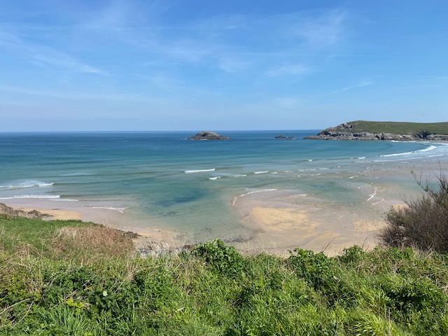
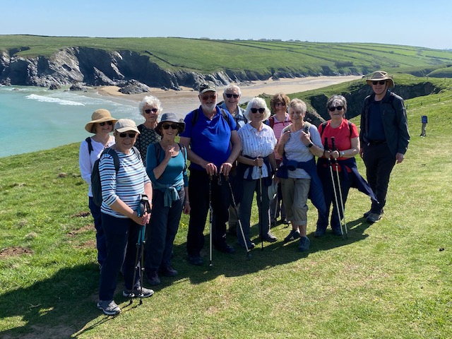
Report of our Crantock to Holywell bay walk 29th April.
Arriving at the National Trust car park in brilliant sun twelve of the walking group met up. We set off along the coastal path towards Holywell Bay taking in the stunning scenery of Crantock beach. At times with the perfect weather what better place to be than on the North Cornwall coast.

We wound our way round the coast line to a point where two weeks ago many seals could be seen, unfortunately today they must have known we were coming and decided to swim off and entertain others along the coastline. (Sorry from the leader).
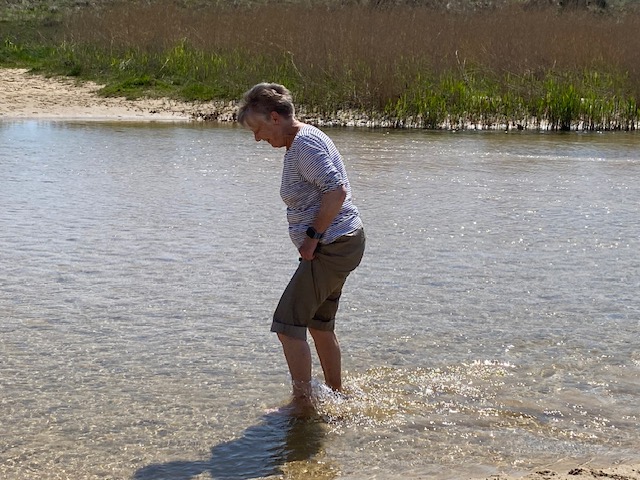
After passing Porth Joke beach we headed for the sand dunes at Holywell Bay we clambered down onto the beach where our picnic lunch was eaten, some even venturing into the water for a paddle.
We meandered our way to the beach bar at Holywell, a welcome stop for ice creams, teas and some indulging in a Guinness. From here we set off inland passed the golf course across The Kelseys and Cubert Common back to the beach car park at Crantock. We had walked about 6.5 miles and everyone said they had had an enjoyable day.
Report on walk of Tuesday 8th April 2025
Hessenford - Seaton – Looe

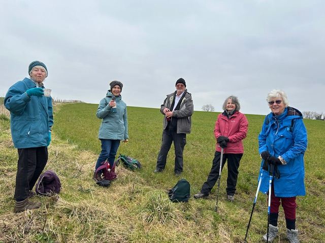
Seven members of the walking group, not put off by the prospect of challenging uphills, gathered in good time at the bus stop opposite the fire station in West Looe to catch the number 10 bus to Hessenford. The sun was shining and there was not a single cloud in the sky.
The first section of the walk was an easy two mile walk through the Seaton Nature Reserve. The source of the river Seaton is in Minions and it connects with two tributary streams running through St Cleer. It runs for just over 10 miles before reaching the sea at Seaton beach where we had our first refreshment break of the day.
We then rejoined the Southwest Coast path to walk to our next destination, Millendreath. The coast path stretches from Minehead in Somerset to Poole Harbour in Dorset. It was created as a route between lighthouses for use by the coastguards so that they could overlook the bays and coves to catch smugglers. A similar coast path in Brittany is called “Le sentier des douaniers”.
This was the most challenging part of the walk as the path seemed to go up and up, again and again. Fortunately, the views were glorious, the spring flowers (wild garlic, violets, bluebells, primroses, three-cornered leeks) and the coconut scented gorse were in the glorious abundance. We heard many skylarks in the field close to the monkey Sanctuary (now permanently closed) and we saw two of them having an airborne fight.

As we got close to Millendreath, we stopped for lunch in a grassy area on top of the cliff and sat around a picnic table. It was time to have a “culture stop” too. In March 1944, the crew of a battle-damaged B17 Flying Fortress long-range bomber aircraft bailed out over the land, leaving just to pilot who took it out to sea to avoid civilian casualties before he himself bailed out. The plane crashed into the sea a short distance away from Millendreath Beach and the pilot was rescued by a local man who rowed out to sea in a leaking boat whilst a local woman bailed out the water. The engines and propellors from the plane were recovered by divers and are now in museums in Looe and St Mawgan, respectively.
Once in Millendreath, Annie took pity on us and we had our third stop of the day for drinks or ice creams (she is definitely getting much softer in her “old” age!). She caught up with a friend and indulged in a hot chocolate with cream and marshmallows – very decadent!


We had been warned that there would be another uphill from Millendreath to Plaidy – there were indeed over 120 steps to climb. There was a third climb from Plaidy Beach to Looe. The writer Eleanor Hibbert lived near Plaidy Beach during World War II and used it as the basis for one of her pen names, Jean Plaidy.
When we got back to Looe, we decided that we deserved another treat! So instead of going over the bridge to walk back to Hannafore where our cars were parked, we took the ferry from East Looe to West Looe (£1 fare). The group had nagged Annie for the whole trip, asking whether they could go back to Looe by boat, so their wish came true.

We all commented on how lovely it had been to walk in a small group – a very friendly group at that!
Walk On Tuesday, 25th March 2025
Sunny Corner to Heligan and Return
Fun And Friendly Fifteen
Sunny Corner lived up to its name for this very sociable friendly short walk. After a bit of juggling of cars 15 set off from the car park, walked a short stretch of the Pentewan trail where we stopped for a photo opportunity before crossing the road to the track through Tremayne Estate woods. 
Although it's only a few miles from where most of us live it was pleasing to lead a walk which many had not done before. There wasn't much wildlife to be seen, except a proud mother duck and her brood of very young ducklings. And one of our group in his shorts!
At the top of a fairly steep gradient we had a choice of either Heligan cafe or Lobbs Farm Shop cafe. In the end everyone chose Lobbs, again a new experience for many, and declared it a success.
Then it was back by the same route, pleasant in the warm Spring sunshine, to the cars. With a feeling that summer is on the way.
Report on walk of 11th March 2025
5-mile circular walk from Grampound to Trenowth
Sixteen members met up in the car park in Grampound for a walk, new to many although we had walked it sometime in 2021. The weather was dry, not too cold and there was hardly any wind. What a treat!
Grampound is at a crossing of the river Fal and is thought to have been a river port from Roman times up until the 17th Century. River smoothed pebbles found when improving the village football pitch indicate that the river was originally much wider. The town takes its name from the Great Bridge built in around 1250 by the Earl of Cornwall and was recorded with a Cornish name of Ponsmur. During the Norman times, it became a hub for traders crossing into West Cornwall and the name was translated into Norman French: Grand Pont.
There are many places of interest on this walk:
- The settlement of Trevillick first recorded in 1216.
- Garlenick Manor which is of late 17th century origin but its splendid walled garden dates from the 1600. The manor was rebuilt in 1812 following a fire but after World War I, the house and gardens fell into disrepair until rescued by the current owners in 1962. With a vision to restore the gardens to their original plan, extensive landscaping and planting, including an avenue of Dicksonia, has recently occurred under the watchful eye of designer, Michael Harvey. The settlement of Garlenick was first recorded in 1334.
- The viaduct built in the late 1850s as part of the construction of the railway from Plymouth to Truro. In 1884, the wooden structure was replaced by an all-stone structure which was cheaper to maintain.
We had a great view of the viaduct when we stopped for our morning break on a little bridge over the river Fal.

- Trenowth Mill which was built in the early -mid 19th century to grind china stone
- Trenowth, a settlement first recorded in 969 as Trefneweth, meaning new farm
One of our members, Jenny MacDonald told us of her visits to the farm manager’s house with her father who worked for a land agent and with her young children.
- The geologically important Grampound Basin – we had a good view of it when we stopped for lunch

- The area of Grampound known as Bermonsay after the London’s leather quarter when Grampound boasted five tanneries and was the centre of Cornish leather. The last tannery to operate closed in 2002.
Report of our 5.15 mile walk circular around the National Trust estate at Trelissick on 25th Feb 2025.
I will start my report by saying what a change it was not to have to cancel a walk due to bad weather.
Seven of us met up at 09.30 at the community centre in town to begin our trip to Trelissick. Another seven joined us at the start of the walk.
We set off at 10:30am in fine weather. Our route took us down to the banks of the River Fal which we followed northwards reaching the King Harry ferry. We continued our journey along North woods and Carcaddon wood before heading along the bank of Lamouth Creek.
On reaching the end of the creek we paused for a photograph before crossing a bridge to take us to the old settlement at the Quay where we stopped for our picnic lunch overlooking the river Fal.
Four of our group decided to return to the car park with the remainder of us setting off on the next leg. In fact one of the four did not see the others turn off so came along with us.
From the Quay a track leads back inland to join a minor road for a short time before we join another track. Our legs are tested having to walk up a moderately steep hill. At the top we join another road before we head back into the parkland surrounding Trelissick House.
As the weather was kind we then found our way to the courtyard café for a well-deserved drink and piece of cake sat outside in glorious sunshine.
Report on walk of 11th February 2025
A 6.5-mile circular walk from Luckett

This was our first walk of the year, as both the January walks had been cancelled due to the adverse weather conditions. Today, the weather was slightly overcast, cold but DRY.
Ten members of the walking group gathered in the free car park in the small hamlet of Luckett for a walk new to all involved. We were very lucky that Roy Dunstan was able to join us for this walk, as his father had worked as the manager of the local mine before moving to Penzance when Roy was five years old.
We first climbed the steep hill out of the village before rejoining the Tamar Valley Trail footpath which took us past the remains of the mining industry. Roy gave us very interesting information about the mine and regaled us with his memories of his early childhood.
I had whetted our members’ appetite when I had told them, in the walk description, that we would see a few things of interest on this walk - we were not disappointed. Here is what we saw on our way to Old Mill:
- A solitary llama in a field
- Brian’s Place: a haven for wildlife on the Deer Park Farm Estate with a shelter, a composting toilet (rather derelict and none of us fancied using it) and a picnic table. How refreshing to come across a farm that welcomes walkers!
- Shetland cattle and their cuddly looking calves
- An abandoned hippy play area, complete with reed wigwams and totems
- Further remains of the mining industry close to the stream we walked along

The second steep hill of the walk brought us past the house where the creator of the hippy play area lives. His meditation hut is open to the public and, as I was guiding my fellow walkers to it, the owner came out to have a chat with us and he gave each of the ladies a hand-painted bookmark. The meditation hut is full of his paintings and the view over the valley is beautiful - we commented that it must be a wonderful place where to practise yoga.
When we reached the hamlet of Sunnymead, we climbed over the second stile of the walk and had a quick coffee break (no time to get comfortable as there was nowhere to sit) and we then made our way across the fields to the hamlet of Lidwell. From Sunnymead to Lidwell, you have great views towards Stoke Climsland, Dartmoor and Kit Hill. In the last field, a group of young heifers got very lively, too lively for our liking but thanks to Nick Warrick excellent herdsmanship, we made it safely to the next stile.
We found another field where to sit and have our lunch break before walking to South Alston (where we had to negotiate a dirty farmyard) and then to Horsebridge in Devon where we had a drink in the Royal Inn in front of a blazing open fire. The lack of comfort for the coffee and lunch breaks were forgotten and forgiven. Phew!
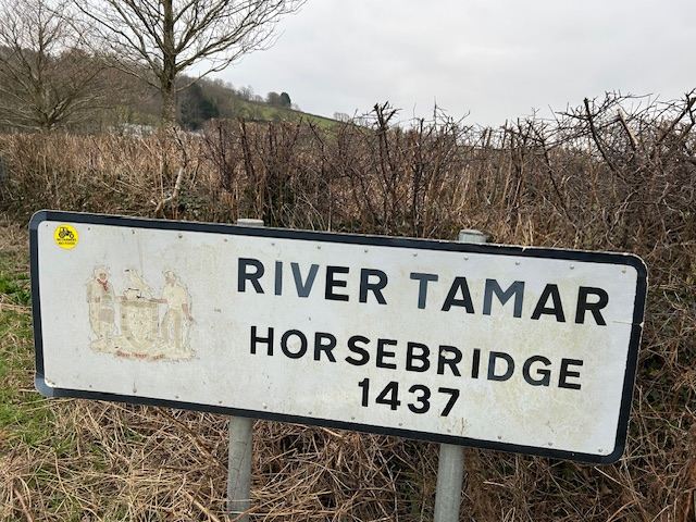

We made our way back over the river Tamar into Cornwall and walked back to Luckett past Lower Hampt where many orchards have been planted. I had warned the walkers that the last stretch of the walk would be very boggy. In fact, we walked on a dry and recently repaired pathway – this improvement could be because this stretch of the walk is part of the Tamara Way.
A great walk and people enjoyed walking in an area that we do not often visit on our walks.