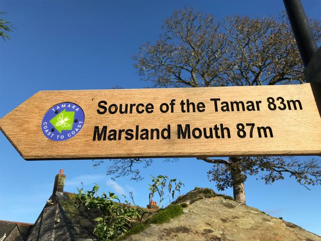
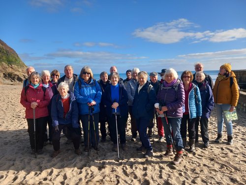
A report of a circular walk from Dunmere to Grogley Holt via Nanstallon and return to Dunmere via the Camel trail on 10th Dec
Fourteen members of the walking group found their way to the Borough Arms at Dunmere on a chilly overcast morning.
After taking a roll call of those that wished to participate in a festive bite to eat at the end of the walk we set off at 10.00am.
The walk initially took us alongside the River camel along a footpath that is usually muddy. On this occasion it was dry. The footpath has been made further away from the bank of the river with a few steps. Reaching the end of this part of the walk we turned left then right to join the lane to Nanstallon. After ascending a gentle incline and a stop for a quick break we then descended to our turning for Grogley Holt. A quick stop for a photograph before setting off again on our return leg to the Borough Arms.

A quick phone call to the pub to reserve 8 seats for those that had indicated they would be participating in lunch and a drink at the end of the walk. Along this stretch we bumped into someone taking their horse for a walk.

We passed the Camel Valley Vineyard and Boscarne Junction Station before arriving back at our cars at approx. 12.45. The walk length was approx. 5.5 miles. The numbers going to the pub have now swollen but room is found for us all. A nice meal and drinks were enjoyed by us all before we parted for our Xmas break.
Well that’s it for 2024 walks, your leaders are now planning walks for 2025. Any suggestion gratefully received.
Report of circular walk from Lostwithiel Community Centre via Restormel Castle and return approx 4 miles
Tuesday 26th November
Unfortunately Janet and Chris were unable to lead their planned anniversary walk but a scratch team of three, aided and abetted by several others in the group, managed to find their way around this local route.
It was a lovely walk, Chris, thank you for the suggestion, but we should point out that it was the 11th anniversary of the first walk you did and not the 10th. We know - time flies when you're enjoying yourself.
So 14 of us, in a brief fine weather spell in between some dreadful weather, clambered up the wet slippery rocky trail at the side of Tanhouse Road and then dropped down through the fields towards Restormel Castle. The view from the top is spectacular, with vistas stretching for miles across the valley, taking in the Castle, Duchy of Cornwall Nursery and Lostwithiel.
The Duchy of Cornwall was founded in 1337 when Edward 'The Black Prince' was made Duke of Cornwall, at the age of 7, by his father King Edward 111 of England. Unfortunately Edward died before his father, in 1376, so he never became King and his son Richard 11 succeeded the throne. The castle is still owned by the Duchy of Cornwall and managed by English Heritage.

The nearby Restormel Manor (now luxurious holiday accommodation run by the Duchy of Cornwall) was built in the 1540s on the site of the Holy Trinity Chapel. One wing of the Manor, forming the smallest holiday house in the Manor, is named Trinity. The Manor is regularly used by members of the Royal family when they have business in the county.
Back in Losty some of the party descended on the Community Centre cafe for sustenance.
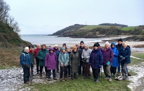
Report on circular walk from Golitha Falls to Sibblyback Lake
Tuesday 12th November 2024

The weather forecast was for sunny weather and seventeen members met up at the free Golitha Falls car park for this easy to moderate 4 miles walk. This is where our walk leader’s misfortunes started: she discovered that she had a flat tyre. Fortunately, one of our members had a pump in his car and it was agreed that on the return from the walk, he would pump up the tyre and follow Annie to Liskeard where she would go and get a new tyre. A true knight in shining armour! Annie could now enjoy a trouble-free walk!
Spoke too soon! Annie had walked many times around Sibblyback Lake but had never started the route from the Golitha Falls. Fortunately Dave, another of our walk leaders, was at hand to call her back when she marched ahead, chatting with a few members, totally oblivious that she had walked past the turn off point! First time Annie had ever led us astray and she knows that she won’t hear the last of it!!!
We were all glad that we were wearing several warm layers as the wind was quite strong at Sibblyback, whipping up waves. A bird watcher on his way back to his car told us what he has spotted that morning but all we saw were huge numbers of Canada geese on the water and in the fields around the lake.

Our walk leader spotted a few black sheep in the field and keen to take photos for the website, she got as close as possible to the edge of the field where she had a nasty encounter with a barbed wire. No, I am not making this up! Anyway, Annie did not notice that she had hurt herself until other members showed their concern when she was queuing for coffee and cake at the Olive and Co café and they noticed the blood either side of her nose.

It looked worse than it was and our First Aid Kit came in useful. Thank you to another walk leader who helped Annie clean herself up and administered a plaster! Very fetching!
We were all impressed by the efficiency of the staff who served us all in no time at all. We can all recommend the cakes!

The story has a happy ending. Annie made it to Liskeard and the offending tyre was replaced in no time at all. She was rather hoping that this series of incidents would disqualify her from continuing in her role as a walk leader – no such luck! She will just have to put up with much teasing on future walks.
Report of circular walk from Par Beach to Tywardreath
Tuesday 29th October 2024
Our short, local walks always seem to be very popular and this approx 4 mile route attracted 19 of our members. It was a mild dry morning for this relatively flat walk which took in some little known trails around Par and Tywardreath. Par was once a tidal creek and we passed geese on the wetland reserve which has since been created. On through the Tywardreath marshes, a bit slippy and muddy under foot, to the village of Tywardreath where we had a refreshment stop sitting on the benches in the grounds of the Parish Church of St Andrew the Apostle. Tywardreath was once the home of a mediaeval priory.

At the end of the walk several members of the party took advantage of coffee and cake at the cafe, before it shuts for the season.
Report of walk from Spit beach car park to Carlyon Bay
on 24th September
It was perfect walking weather, dry, not windy, not too hot, when 15 of the group met for this fairly short, relatively easy local walk of approx 6 miles.
So we skirted the workings of the old Par Moor Docks, looked down on the soft sandy beach of Spit, and kept to the edge of Carlyon Bay golf course to keep away from any stray golf balls. It was pleasing that although this walk begins about 5 miles from Lostwithiel, several of the group had never walked it before.

We then meandered through some of the roads of Carlyon Bay through previously unknown 'snickets' to get to AJ's cafe which provided good coffee and scrumptious cake. and friendly service. Our group took over the outside gazebo, before making our return journey by the same route.

"I see no ships"
Another pleasant morning out with like minded sociable people.
Report of walk from Lostwithiel to St Winnow (+ return) on 10th Sept 2024
It was on a somewhat overcast day that nine of us set off from the community centre at 10:30am. Another two joined at the Chatham Inn and one more at Coffee Lake. Our U3A chairperson joined from his home on route. After going past Newham Farm we headed along the track signposted as impractical for motors. We encountered a very large muddy puddle which some of our group decided to take a closer look at. Unfortunately I could not get the camera out quick enough to catch an action shot.


On arriving at St Winnow we made use of the benches in the churchyard for our lunch stop. While we were there the little café opened up and some took the advantage of a cup of coffee/tea/ice cream.
We proceeded through the boat yard to follow the River Fowey ( I must apologise for omitting to inform members we would encounter two stiles along the way) before breaking out of the woodland into fields to face Newham Farm. A vote was taken if to walk back along the track with the large puddle or divert back along the road. The road won. Along the way back we said goodbye to the people that we picked up along route before returning to Lostwithiel centre.
Luckily the rain held off until we were back in Lostwithiel centre after walking just over 6 miles.
REPORT OF WALK OF 9TH JULY 2024
GROWING UP ON A FARM IN THE 1960S - A WALK BACK IN TIME

Our 9 walkers on 9th July 2024 were taken on a trip down memory lane. Led by Nick Warrick, we walked around Lower Trenode Farm where he grew up and we were treated to insights of his rather idyllic childhood. The weather had been wet for several days, but the rain held off and we stayed dry for the whole walk.

REPORT OF WALK ON THE 25th JUNE
ST. BREWARD TO LANK AND BACK

On a bright sunny day 15 of us started off on this walk just past the church, a church which dates from the Middle Ages and claims to be the highest in the county. At least five of us had done this walk previously but nobody could remember when! and one of our present group had done it 20 years ago-so the fact we had not done a recce was not important. No one could remember any stiles or any major ups and downs.
We started with a steep descent into the valley, most of it being under the cover of trees so keeping the heat down but as we all know what goes down must eventually come back up! We now reached Lamphill woods and walk along flat land and the first of many difficult stone stiles with help needed at some and care needed at most to ensure no broken limbs. On the way we pass part of Coombe Mill Farm which is a family friendly holiday farm with many animals wandering the paddocks. Onwards past more stiles and bridges across the River Camel and then the walk started uphill through fields and more gates/stiles and seemingly more fields and gates until we reached the main road into St Breward and the start of more lanes and paths uphill, eventually passing the school and the glorious site of the Old Inn where we could rest for a bite to eat.
Although we had only walked about 3.5 miles (3.1 according to the walk guide) I think most of us thought the walk to have been strenuous but well worth the effort.

Caption: we are not lost - we just do not know exactly where we are!
WALK ON 11TH JUNE 2024 - 5 MILE CIRCULAR ROUTE CARADON HILL
This was a repeat of a walk we did almost exactly two years ago on this scenic route which was once the centre of Victorian copper mining. It's a fascinating mix of ruined engine houses and spoil tips and gives amazing views across the surrounding landscape.
Twelve members of the group turned out today, on a dry but blustery day on the dramatic moors,
WALK ON THE 28 th MAY-NEWQUAY TOWN WALK AND PENTIRE POINT

Report of circular Woodland walk from Cardinham 4-5 miles 14 May 2024.
Fourteen intrepid walkers set off from Cardinham Parish Hall in spite of rather dire weather
forecasts for rain and winds! We were able to use the Hall car park – more spacious than I
remembered - having hired the Hall in advance at a very reasonable rate, to avoid causing
parking problems in the village. We followed well maintained footpaths through country
lanes, fields, and woodlands, seeing en route lovely wild flowers, stunning newly green
trees, and hearing birdsong and streams gushing with fast flowing water, as well as the
chatter of our group members.

Mid-way was a welcome coffee and cake stop at Woods Cafe, always a treat. We then
resumed our walk, returning to Cardinham village via quiet country lanes and footpaths.
The weather was kind to us, and the walk relatively easy, so we enjoyed ourselves and were
glad we had braved the gloomy weather forecasts.
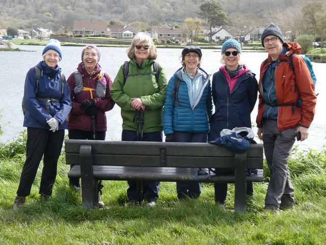
Report on our 7 miles walk from Cremyll to Torpoint
Seven members the group, encouraged by the sunny and dry weather and not deterred by the high winds, made their way to the car park in Cremyll to undertake a shortened version of the first leg of the Tamara Way which our walk leader has been walking. The Tamara Coast to Coast Way is a walking route spanning our Southwest Peninsula between its south and north coasts. It runs closely parallel to the boundary between Devon and Cornwall, which for most of the way follows the course of the River Tamar. The creation of the Tamara Coast to Coast Way is one of the first projects to be completed as part of the Tamara Landscape Partnership Scheme with support from the Heritage Lottery Fund. It opened in the second half of 2023 and recently featured in an episode of Countryfile.
Our walk can be split into 4 sections:
1. From Cremyll through Empacombe to arrive at the road to Anderton
2. Anderton to Millbrook
3. Millbrook to St John
4. St John to Torpoint.
You may be forgiven for not having noticed the arrival of our spring flowers, as the weather has not encouraged us to go for many walks. We spotted many bluebells on this section of the walk - a cheerful sight indeed!
Empacombe is an attractive little spot with its own harbour on the river Tamar. Notable are the almost castle-like walls and gate on the left after the cottages. Surprisingly, this substantial wall built in 1788 only encloses the kitchen garden for Mount Edgecumbe House.
In Anderton, we walked past very attractive properties which were built as the village of Millbrook was becoming popular among those with money. We crossed over the dam across Millbrook Lake which was built in 1977 as a flood prevention measure.
Our first stop was at a picnic table by Millbrook Lake. The name does not denote a lake in its modern sense of the word but comes from the Old English lacu, meaning a watercourse, including a tidal one. Millbrook Lake is the first of a number of such lakes encountered on the Tamar Estuary.
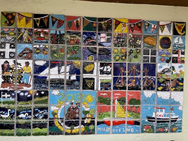
Whist in the village of Millbrook, we made time to admire the art work in the bus shelter which consisted of a mural made of ceramics tiles, very cleverly put together. Local people waiting in the bus stop explained that the art work was the result of a project completed by the pupils of the local primary school.
Now, we could no longer put it off: after an easy start of the walk, we had to tackle two moderate hills and a few stiles on our way to St John. Historically, this was referred to as St John in Cornwall (until 1844 part of the St John Parish was in Devon). St John was once a place of trade with shipping reaching the village via the estuary of St John's Lake. The St John Inn is only opened at week-ends, so we were able to use the tables on their terrace for our picnic lunch.
On our way to Torpoint, we left the road for a while to walk on a permissive path through Benskin's Wood in order to reach St John's Lake, a Site of Special Scientific Interest, designated particularly for its birdlife. A more macabre tradition is that prisoners who had died on prison ships moored in the Tamar would be buried in the mudflats. A headland on the north side is called Deadman's Point.
We then walked through fields to find the path that takes you next to HMS Raleigh's metal security fence. HMS Raleigh is the largest Royal Navy establishment in the southwest and is the only training centre for new recruits to the Royal Navy or the WRNS. Has we wished to continue walking the first leg of the Tamara Way (as per the guide book), we would have walked to the Torpoint Ferry, crossed the Tamar before walking to the Tamar Bridge - a 12.5 mile walk!
We only had to wait 30 minutes to catch the number 70 bus back to Cremyll for a 50 minute ride around the Rame Peninsula which was enjoyed by all, especially as we could all sit upstairs in the double decker and enjoy the dramatic cliff top views - a ride described by one member as the "icing on the cake".
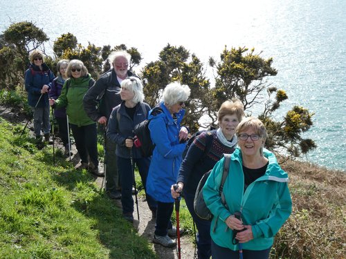
Report of walk 6ish mile circular from Penare via Gorran Haven to
Dodman Point on 26th March 2024.
This was the 3rd/4th time we have tried to undertake this walk as on all other occasions the weather has beat us. We were lucky this time picking one of the few dry days he have had this year.
After leaving Lostwithiel we headed for the National Trust car park at Penare encountering a rather large puddle on the minor road to the car park. With the sun shining on us we headed from the car park back up the road a short distance and took the footpath through Treveague campsite where they were preparing for the new season. From here we took the path down into Gorran Haven for a coffee stop. I think everyone also indulged themselves in cake whilst sitting in the brilliant sunshine. Thinking about the cake and the calories we thought we had better continue with the walk.
The route took us up some steps to get onto the coastal path which in the main was quite dry. A couple of rest stops were made on the way to Dodman Point to admire the view and to soak up the sun. Along the path the National Trust has both Shetland and Dartmoor ponies grazing.
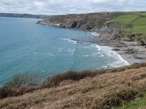
We stopped for our lunch in the sun at Dodman Point before heading towards Hemmick Beach. From here we followed the track back to Penare car park for the return to Lostwithiel.
REPORT OF WALK ON 12TH MARCH 2024 CAMEL TRAIL FROM BOROUGH ARMS BODMIN TO WADEBRIDGE
ALMOST 6 MILES AND APPROXIMATELY 12,000 STEPS
Following one of the wettest Februarys on record, walk leaders Carol and Sue chose a relatively wet and mud free walk along the Camel Trail. Undaunted by slightly damp and drizzly weather, as you can see in the pictures, 14 stalwart members of our walking group enjoyed an easy unchallenging walk and a nice chat along the way.
Some wildlife was seen, including some Canada geese and mallards, a few lesser spotted cyclists and walkers with dogs.
Most of the group then dipped into various cafes and shops in Wadebridge, before using their bus passes to catch the No 11 back to Borough Arms to collect cars for return to Lostwithiel.
All in all a pleasant way to spend a few hours, with promise of better weather and many more walks to come.
Report of walk on Tuesday 30th January 2024
They say a picture is worth a thousand words and this photo says it all.
Taken on Pentewan Beach, under clear blue skies and warm wintry Cornish sunshine, 21 members of our walking group enjoyed an easy stroll along the bank of St Austell River to coffee and scrumptious cake at the Little Bay Cafe.
We began at Kingswood, through woodland managed by the Woodland Trust. The trail is part of the National Cycle Network which goes to Mevagissey, and also part of the 180 mile cycle route which runs from Lands End to Bude. On this day we saw a small number of cyclists and runners and several dog walkers out enjoying the balmy weather.
The trail is embedded in Cornish China Clay history from its time with horses and carts, through to a railway line built to transport china clay to the once bustling port of Pentewan.
After our coffee break we strolled down to the beach before making our way gently back to our cars at Kingswood.
A short report on our first walk of 2024 (9th Jan)
It was on a cold morning that many of us met up in the community centre carpark with the remainder going straight to Coombe Farm carpark the starting point for our walk. Whilst gathering at the centre snow began to fall and after a rearrangement of lifts we set off.
I’m pleased to say by the time walking boots, coats etc were put on that the snow stopped falling as the walk started.
In total 20 members of the walking group set off mid morning for our circular walk taking us to Southground point and Polridmouth where one or two of the group thought it would be nice to have a dip in the sea.
After they recovered from that mad idea we set off uphill along the costal path to Readymoney via Alldays field. The field was named after G James Alldays who presented the field to the people of Fowey in March 1951 and was an English automobile maker from 1898 to 1918 (history lesson over with).
After our bracing walk a morning coffee stop at the kiosk on Readymoney beach was welcomed before our climb back up to top of Alldays field and return to the cars.